 Live Music Archive
 Librivox Free Audio
 Metropolitan Museum
 Cleveland Museum of Art
 Internet Arcade
 Console Living Room
 Books to Borrow
 Open Library
 TV News
 Understanding 9/11
Diomedia nigripes (black-footed albatross) and Diomedia immutabilis (Laysan albatross)
Bookreader Item Preview
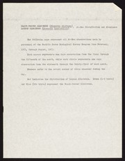
This folder contains maps showing distribution and abundance of Diomedia nigripes (Black-footed Albatross) and Diomedia immutabilis (Laysan Albatross) based on at-sea observations from February 1963 through August 1965 for the Pacific Ocean Biological Survey Program. Distribution and abundance data are represented by symbols, numbers, and colors added to printed maps of the central Pacific Ocean. Each map records data from one calendar month, with one map for each month of the year. No year information is shown on the maps, although an explanatory page in the folder says that the maps represent observational data from February 1963 through August 1965. Each map may therefore represent data collected during that month in one year or more than one year. Each symbol (square or circle) on the map represents one day's observations; letters, numbers, and colors added to the symbols represent species and number of birds of each species. The map legends and explanatory sheet in the folder provide additional information on interpretation of the maps
![]() This book is
available with additional data
at
Biodiversity Heritage Library.
This book is
available with additional data
at
Biodiversity Heritage Library.
Reviews
There are no reviews yet. Be the first one to
write a review.
266 Views
IN COLLECTIONS
Biodiversity Heritage Library BHL Field Notes Project
Uploaded by Smithsonian Libraries and Archives on
